


Verification of Well Locations - Jordan
 Survey and verification of well locations
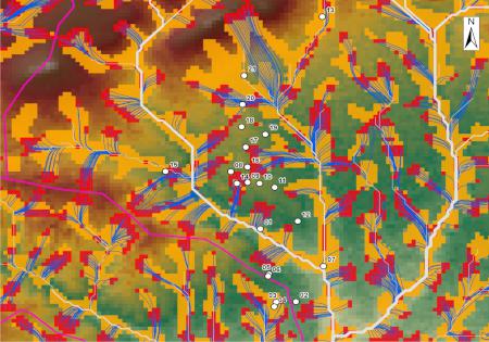
The Amman South project was designed to survey and verify the already existing well locations, independent from their productivity and based on a geomorphological analysis. At first, wells were located by means of GPS and their productivity was requested from the owners. Later, the topographical conditions were compared with geomorphological analysis results. The outcome was a high conformity level between the actual water gained from wells and the geoanalytical results with GeoSPIRS.
Project/technical data:
| Area south of Amman | 50 km² |
|---|---|
| Surveyed wells | 21 |
| Data basis | SRTM 90 |
| Method of analysis | GeoSPIRS |